Document the King Tides at the Rose Creek Salt Marsh
November 26, 2026 - 8:45 AM to 9:45 AM
San Diego
California King Tides Project at the Rose Creek Salt Marsh and Estuary

The California King Tides Project helps people visualize future sea level by observing the highest high tides of today. You can help by taking and sharing photos of the shoreline during King Tides to create a record of the changes to our coast from sea level rise.
King Tides themselves are not caused by sea level rise, but allow us to experience what higher sea level will be like. King Tides are the highest high tides of the year, about a foot or two higher than usual, which is what we expect to see during the next few decades. When you observe the King Tides, imagine seeing these tides (and the associated flooded streets, beaches, and wetlands) every day. Understanding what a King Tide looks like today will help us plan for sea level rise in the future.
This self-guided event will allow the public to document the level of tides from the Mike Gotch Bridge to Garnet Avenue and beyond. Bring cameras and/or smart phones and tablets capable of taking images. To set up the app on your device, click here for instructions.
Today’s high tide is documented to be 9:15 AM at Crown Point. It might be a few minutes later at Rose Creek.
Join teams of citizen scientists who are creating data to help us all plan for Sea Level Rise. For more information about the California King Tide Project website.
Recommended Places to Document
The photos below are places that we have documented in the past. Documenting these places is good to keep the data sets similar. Feel free to document other interesting places as well. The more data the better.
From the Mike Gotch Bridge
Looking south (downstream), document the docks adjacent to Campland on the Bay as shown in this photo of an extreme low tide.
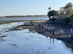
Docks adjacent to Campland at the mouth of the creek at low tide
Looking northish or upstream towards Grand Avenue. Take images showing the fence between the bridge and the San Diego Mission Bay Boat & Ski Club. See the fence below:
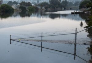
Fence between Mike Gotch Bridge and Boat & Ski Club at a King Tide.
Bike Path under Grand Avenue
Document how close the water level is to the bike path. Or if the water is up on the bike path, use an object to show how deep it is.
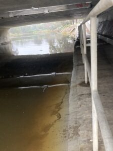
Rose Creek bike path under Grand Avenue
Garnet Avenue Bridge
Document tide levels on the upstream and downstream end of the creek from the Rose Creek Bike Path by the Garnet Avenue Bridge.
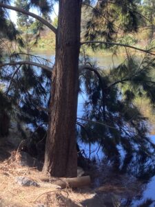
Tree between Creek and Bike Path just downstream of Garnet Ave Bridge
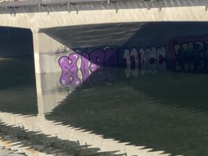
Graffiti on Garnet Ave Bridge foundation as seen from Bike Path
Also any place upstream of the Garnet Avenue Bridge off the bike path that you can get to where the tide is coming in and going upstream. Normally, the fresh water is running downstream.
Thank you for being a community scientist!