King Tides Project at Rose Creek Salt Marsh and Estuary
January 3, 2026 - 7:30 AM to 9:00 AM
San Diego
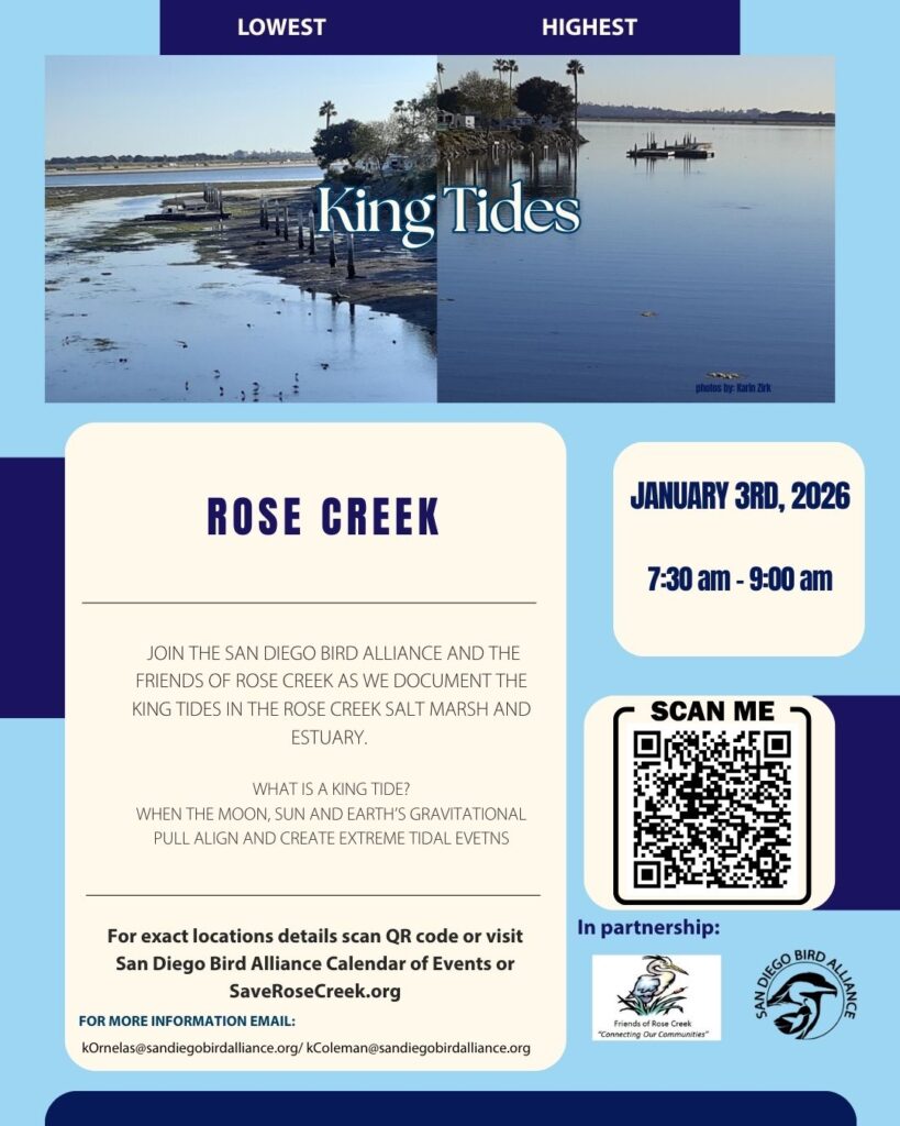
Join the Friends of Rose Creek and our partners at San Diego Bird Alliance as we document the King Tides in the Rose Creek Salt Marsh and Estuary adjacent to Mission Bay High and Barnard Elementary Schools.
Bring your app enabled device and we’ll help you get set up to be a community scientist helping to project what sea level rise in our community will look like. Today’s tide is projected to be a 7’4″ tide which is high at or shortly after 8:20 AM.
Download the Survey123 App (in English or Spanish) ahead of time.
The full moon takes place at 2:02 AM on January 3rd so the full force of gravitational pull is in play.
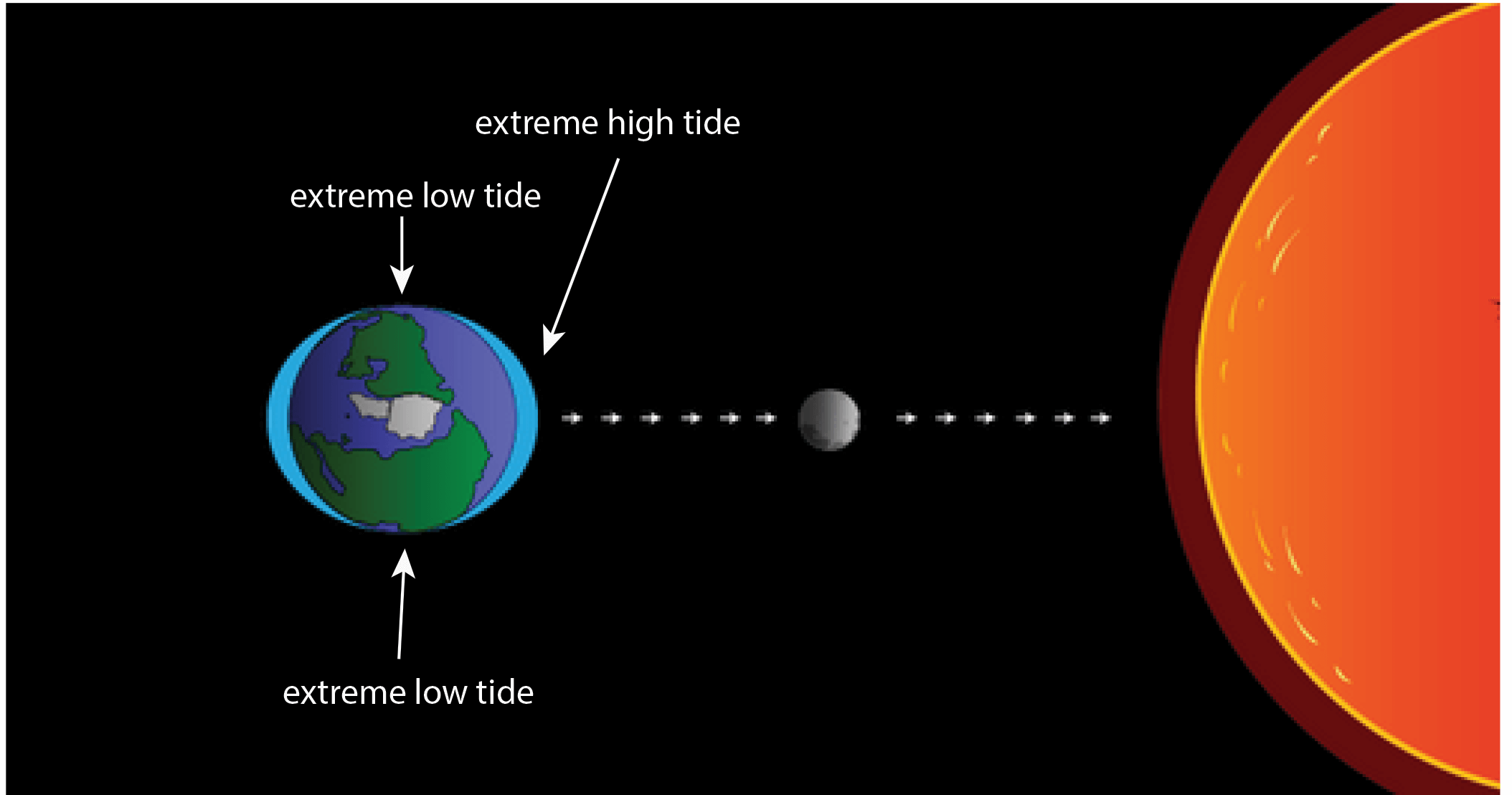 When the gravitational pull of the Sun and moon are combined, you get more extreme high and low tides. This explains high and low tides that happen about every two weeks. Note: this figure is not to scale. The Sun is much bigger and farther away.
Use your smart phone or digital camera to participate in the Project by taking and uploading photos of king tides through the King Tides Photo Upload form. Start by choosing where you’ll go to take your photos and then look at the tide map below to find out what time and how high your king tides will be. Take your photos as near to high tide time as you can. Your photos will be displayed on an interactive map. (If you’d like to share a video clip of king tides with us, please email kingtides@coastal.ca.gov for instructions.)
* LEARN HOW TO UPLOAD YOUR KING TIDES PHOTOS *
In addition to uploading your photos, you can also share them on social media using #kingtides. We’ll be liking and sharing your posts throughout the King Tides season.
For more information on how to participate, visit the King Tides Project.